Gomukh Tapovan trek: Witness the marvelous beauty of this Uttarakhand Trek
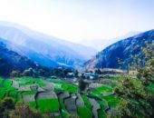
The Gomukh Tapovan Trek is among the most cherished trek trails of Uttarakhand. Lofty mountains surround the trek and trail passes through dense deodar forests, close to the roaring Bhagirathi river. With the thin air at Gangotri, the base camp, the trek makes for a striking and challenging setting. Gangotri is well known as the river that gives water to the holy river Ganga (with the actual source being Gaumukh).
Pic Credit : Saurabh Jain (creative common)
According to legend, King Bhagirath prayed to the great Shiva for achieving salvation for his 60,000 sons’ souls. Lord Shiva obliged and requested the Goddess Ganga so she would release her water for the purification of the ashes of Bhagirath’s sons. Due to this mythological story, the river Ganga got the status of being a source to purify souls. The trek is at an altitude of 10,055 ft, and it takes around 10-12 hours through a drive to reach Gangotri from Haridwar.
It is a moderate to challenging trek and the best time to undertake it is during the summer months of May, June and through August to October.
Your Itinerary for seven days for a memorable Gomukh Taposan Trek
Your arrival point remains Haridwar, and then you can take a drive to reach Gangotri and start the trek from that point to Chirbasa. It will take first two days of your travel.
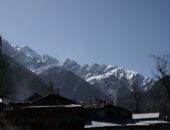
You destination after Gangotri will be Chirbasa (10,055 ft to 11,761 ft) which will take 6 hours covering 9 km. It is a moderate trek with start of trek covering 300 m steep ascent. You will walk past the Forest Check Post, Gangotri bus stand, the market area. You will notice the Sudarshan Parbat (21,345 ft) looking amazingly beautiful and the Bhagirathi River along with some isolated glaciers. Many waterfalls and streams lie en route along with snow-capped mountain ranges, blue pines and silver shining birch trees. Chirbasa is located close to the forest cover and remains the first night on the trek campsite.
The Bhagirathi river flows right to the Chirbasa campsite making it all the way more hypnotic. Enjoy the beautiful views of the glacier and chirping sound of the river.
Day 3 :
You will trek from Chirbasa to Bhojbasa (11,761 ft to 12,450 ft) and take an acclimatization walk to Gaumukh, so your body gets used to the low temperature. Day three trek will take around 3 hours and cover 5 km with the trek being moderate and gradually ascent. Since there is no water source en route, you will have to carry two liters of water with you for avoiding dehydration.
As you enter the valley at Chirbasa, you will see magnificent snow-clad peaks. This trail links with the Gaumukh trail. You will notice that the broken terrain in some sections. You will trudge through silent hills and reach close to the Bhagirathi peak and encounter some streams en route. The most far-reaching point of the valley is Bhojbasa, and the trek to this point is quite even and picturesque. Once you reach the vantage point in Bhojbasa, you will be able to see the entire valley and the Gaumukh Glacier along with the Mt Shivling. You will spend the night at the campsite in Bhojbasa. Take an acclimatization walk to Gaumukh (and back to the campsite).
The acclimatization walk is essential to get your body used to the temperature. It ensures your rest of the journey remains exciting and you don’t fall sick.
Day 4:
It will take you from Bhojbasa to Tapovan via the Gaumukh (12,450 ft to 14,202 ft). Bhojbasa to Tapovan is around 7 hours and cover 9 km on day four. This trek is quite tricky as you will climb a gradual ascent and then a moderate rise followed by a steep increase. Like before, you will have to carry water with you since there are no sources of water available en route.
You will have to get to Gaumukh following the same trail as before, and then your trek to Tapovan will start. This part remains the most challenging part of the entire trek because it includes climbing glacial moraine and passing the Gaumukh glacier. You will be crossing steep landslide-prone areas along with a frozen stream known as the Akash-Ganga. The terminal moraine is hard ice and boulders so there is always a chance that it can get slippery in some areas. It is best to take a local guide with you through this point. You will have to climb the moraine before lunchtime to avoid any rock falls as the water increases when you are coming down to the Akash Ganga. If the water is too high at the Akash Ganga, then you will have to cross the stream barefoot.
OR you can try boulder hopping as well. After a brief break post crossing the stream, you can begin your steep climb to Tapovan which is only a couple of hours from this point.
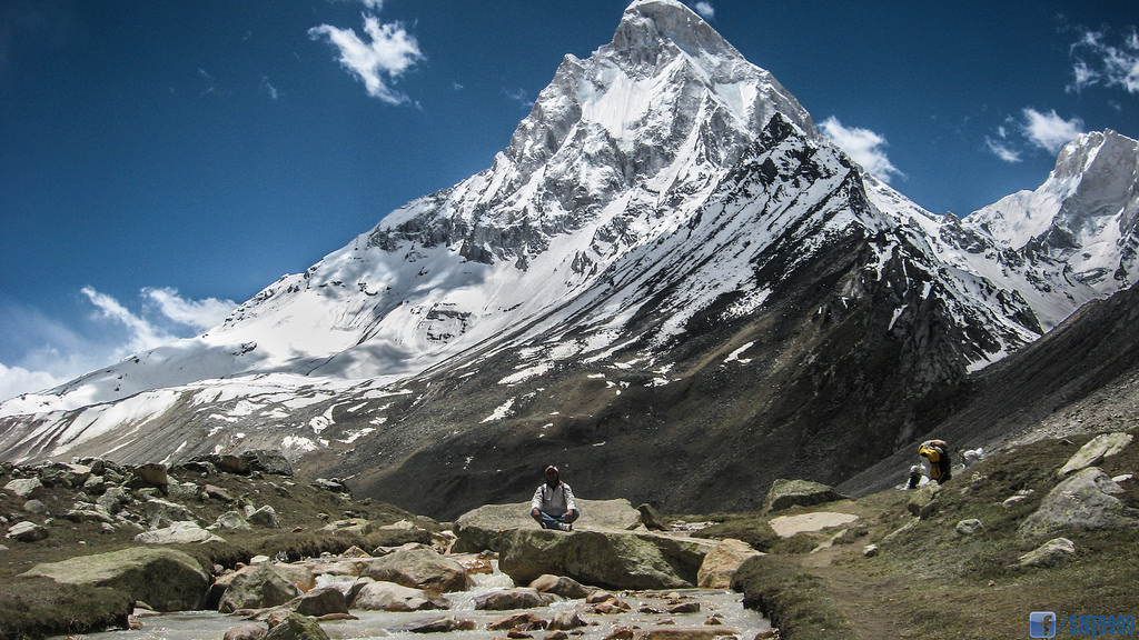
What’s worth cherishing from the Tapovan campsite is astonishing views of the glaciers and valley. The Mt Shivling, Meru, Sumeru, Bhagirathi peaks, Thenu and Sudarshan Parbat are all visible from this point. If you want to see the Shivling from close, then you can walk all the way to the ashram.
Day 5 :
Your day five of Gomukh Tapovan trek will include exploring the beautiful Tapovan. This high-altitude alpine meadow right under the Mt. Shivling is a lovely spot to spend a day. It is expanded over 2 km (length) and is a vast level ground. You will have to pick a campsite carefully since some areas may be wet. Tapovan is a famous location among holy men who still practice religion and praying here.
With a brief trek from Tapovan from Neelatal, you will reach another vantage point where you can see the mighty Meru. It’s best to take the trek to lunch so you can enjoy the meal at the campsite.
Day 6 :
You will trek back from Tapovan to Chirbasa (14,202 ft to 11,761 ft) for 8 hours covering 14 km. It is quite a challenging trek, and it will be a consistent descent with an even trail to Chirbasa. Like before you will have to carry water due to the lack no water sources on this trek. Your trek back to Gaumukh will consume around 3-4 hours, and then you will take the same route back to Bhojbasa and Chirbasa.
Day 7 :
You will trek back from Chirbasa to Gangotri (11,761 ft to 10,055 ft) for 4-4.5 hours covering 9 km. Like earlier, this is a moderate trek and same as your day2 trek. Since water sources streams are available, you won’t have to carry water with you. You will follow the routine from your day two to reach Gangotri, and then a drive to Haridwar is sufficient.
Spend the day in Haridwar, enjoying your walk in the city of the Ganges river. The town is indeed worth a day and full-fledged trip since it has splendid views of some peaks and moderate altitude. If you are in a mood for shopping, then the city will serve you right. The city has numerous shopping centers for religious and non-religious merchandise.
Other recommended treks in Uttarakhand: Roopkund Trek